Current stop: Bishop, CA.
The Sierra Nevada section of the PCT has been nothing short of spectacular so far. The past three days especially have not only been the most scenic on trail, but perhaps the most beautiful I’ve ever seen (big call, I know). Apologies in advance with the number of photos in this post.
Days 41 and 42 were spent at Kennedy Meadows South (KMS). During these two days, I sorted my resupply, collected my snow gear (gloves, bear canister, spikes, and ice axe) and spent time with others celebrating the official end of the Desert Section of the PCT with fellow hikers. Despite two ‘zero’ days at KMS, it was anything but relaxing. KMS is a stop that is known to be a vortex; people arrive and tend to stay much longer than anticipated given the social vibe.
 |
| The crew at KMS |
Luckily, after getting our fill of non-camp food for two days (and a very mediocre karaoke performance by yours truly, which will not be uploaded), we were ready to head back to trail and start the Sierra section.
Shortly after leaving KMS on Day 43 and entering the threshold of the Sierra, our long-distance PCT permits were checked to ensure that we were ‘allowed’ to be hiking (permits are required to hike the PCT and are checked often in more popular parts of the trail (especially the Sierras)). For a large portion of the Sierras, the PCT follows the John Muir Trail (which is a 230mi trail from Mt Whitney to Yosemite Valley) which is offered by way of an advanced lottery system.
 |
| First view of the Sierra after exiting KMS |
 |
| Looking a lot different to the Desert |
We quickly ascended to an elevation of 10,000 feet and the majority of our time in this section will be spent at or around this elevation. Most days will involve crossing a mountain pass. Hiking at this elevation definitely feels considerably more challenging than the lower elevation that I’ve been used to (this in combination with a much heavier pack meant slower going for sure).
After a lunch swim, I hiked the final few miles to camp. Water is abundant in the Sierra and you generally do not need to carry more than a litre at a time (a very welcome change from the Desert). I also ran into another person who checked my permit (the same person from Day 1 of my hike and remembered me).
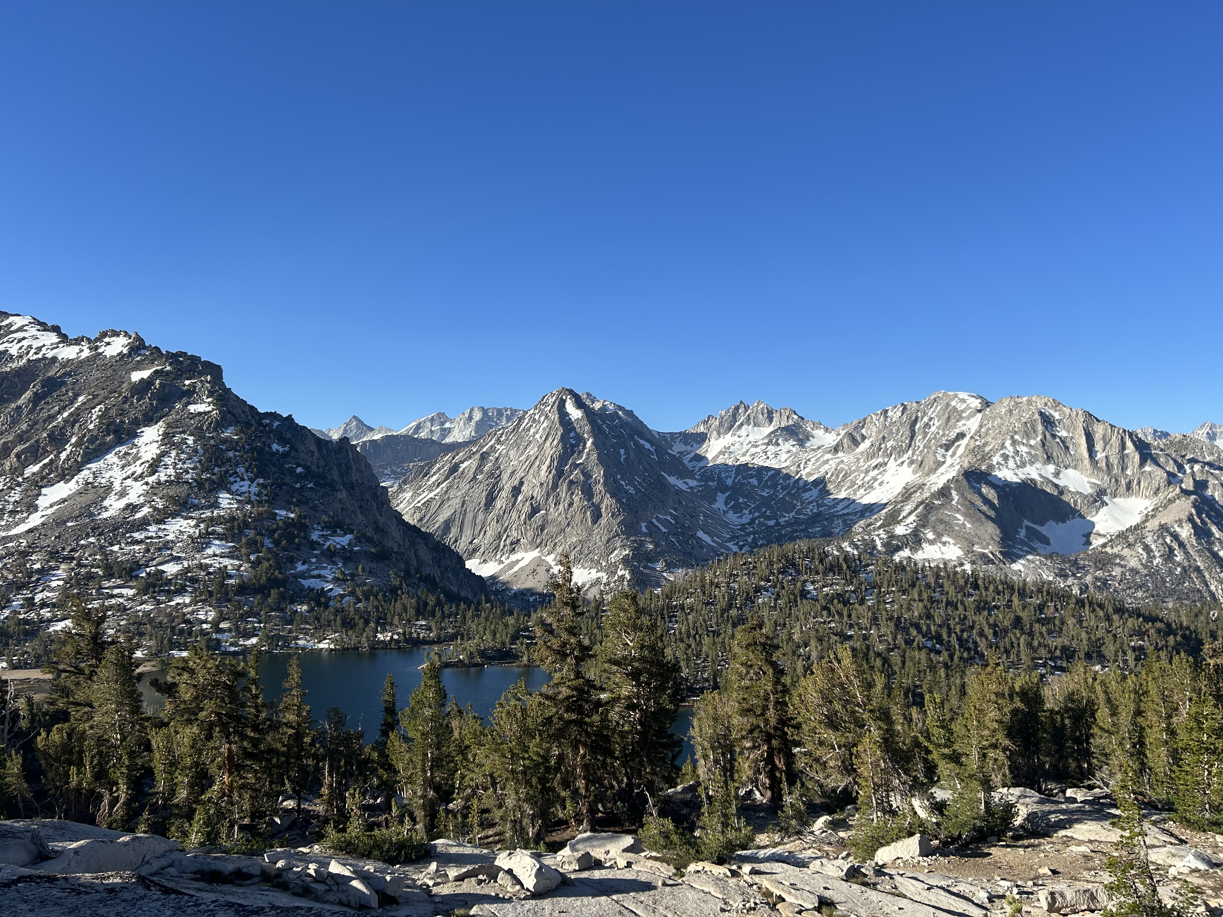
Day 44 involved hiking along the ridges with views of Owens Valley on one side and the granite-covered vastness of the Sierra on the other. Throughout the day the peaceful serenity of the environment was broken by regular fighter jet training given the proximity to a nearby airforce base.
 |
| Photos don’t do justice to the sheer vastness |
Animal life also changes in the Sierras. Chipmunks, pikas, bears, and marmots (my favourite) replace the lizards, rattlers, and mountain lions.
Day 45 involved the first ‘Ducky Challenge’ - a challenge to swim in a number of the alpine lakes (regardless of the temperature) in the Sierra. Chicken Spring Lake marked our lunch spot and the first of such lakes.
 |
| Chicken Spring Lake |
 |
| Lunch with the crew before the dip |
After a refreshing (read: freezing) dip and a couple miles of hiking, we entered into the first of the many National Parks that the PCT covers: Sequoia National Park and Kings Canyon National Park. The views were breathtaking descending into the valley.
 |
| First National Parks on Trail |
 |
| View into the valley below |
In a ‘usual’ snow year, the earliest entry into the Sierra is generally around mid-June. 2024 is a slightly higher-than-usual snow year so with our entry in early June, I was surprised (at that stage) by the relative lack of snow on trail.
 |
| A small lake just before camp |
Day 46 involved getting to Crabtree Meadows in anticipation for an ascent of Mt Whitney (the highest mountain in the continental United States) the following morning. Luckily, the thunder and hailstorm (the first rain on trail) at 5pm lasted less than 30 minutes and the forecast looked great for a midnight ascent.
 |
| Approaching Crabtree Meadows |
 |
| Somewhat picturesque |
 |
| Somewhat less picturesque |
At 12:02am on Day 47, we set off for Mt Whitney. Despite the summit only being 8.7mi from camp, it took almost four hours to reach.
 |
| A great sign given the thunderstorm a few hours prior |
Most people slackpacked the summit (only taking the essentials for the the hike and leaving all other items at camp). Unsurprisingly, it was freezing at the top and I was wearing all the layers I owned. The sunrise at the summit was truly spectacular and was the most beautiful sight I’ve seen. The photos simply cannot do the views justice.
 |
| Most of the crew |
 |
| Feeling pretty chuffed |
After several hours at the top, we forced ourselves to leave and made our way back down (stopping at Guitar Lake for the second of the Ducky Challenge swims, naturally).
 |
| Views on the descent |
 |
| Guitar Lake |
After several hours at camp (and a failed afternoon nap) a few more miles were hiked to the next campsite. I was in my tent and sleeping by 5pm - an amazing but exhausting day on trail.
My alarm woke me up at 4:45am the following morning for an ascent of Forester Pass. At 4,009m, Forester Pass is the highest point on the PCT-proper (given that Mt Whitney does not technically form part of the PCT). Snow covered the initial switchbacks so a straight vertical ascent with the ice axe proved the easiest route before reaching the upper (and non-snow-covered) switchbacks.
 |
| Approaching Forester Pass |
 |
| Me ft. ice axe |
 |
| View from the top |
 |
| Can you tell I like my ice axe? |
After reaching the pass there were two options for the descent: hiking down or glissading. Naturally, the latter was the only viable option, so after finding a spare rubbish bag in my pack which I fashioned into a pair of pants, I reached lower elevation (at speed).
 |
Hiking down
|
 |
| Hiking down |
 |
| Not bad, right? |
The rest of the day involved descending back into the valley (with an obligatory swim in the semi-frozen alpine lake).
 |
| Pre-swim ❄️ |
 |
| Glad I didn’t need to cross this river |
 |
| View on the way to camp |
 |
| Dinner at camp |
The talk at breakfast at camp on Day 49 was centred around the bear that had made its way into our campsite and the resulting commotion of scaring it away. I had slept with earplugs that night so was completely oblivious to the ursine occupant (I’m not sure if that’s a good thing or not?).
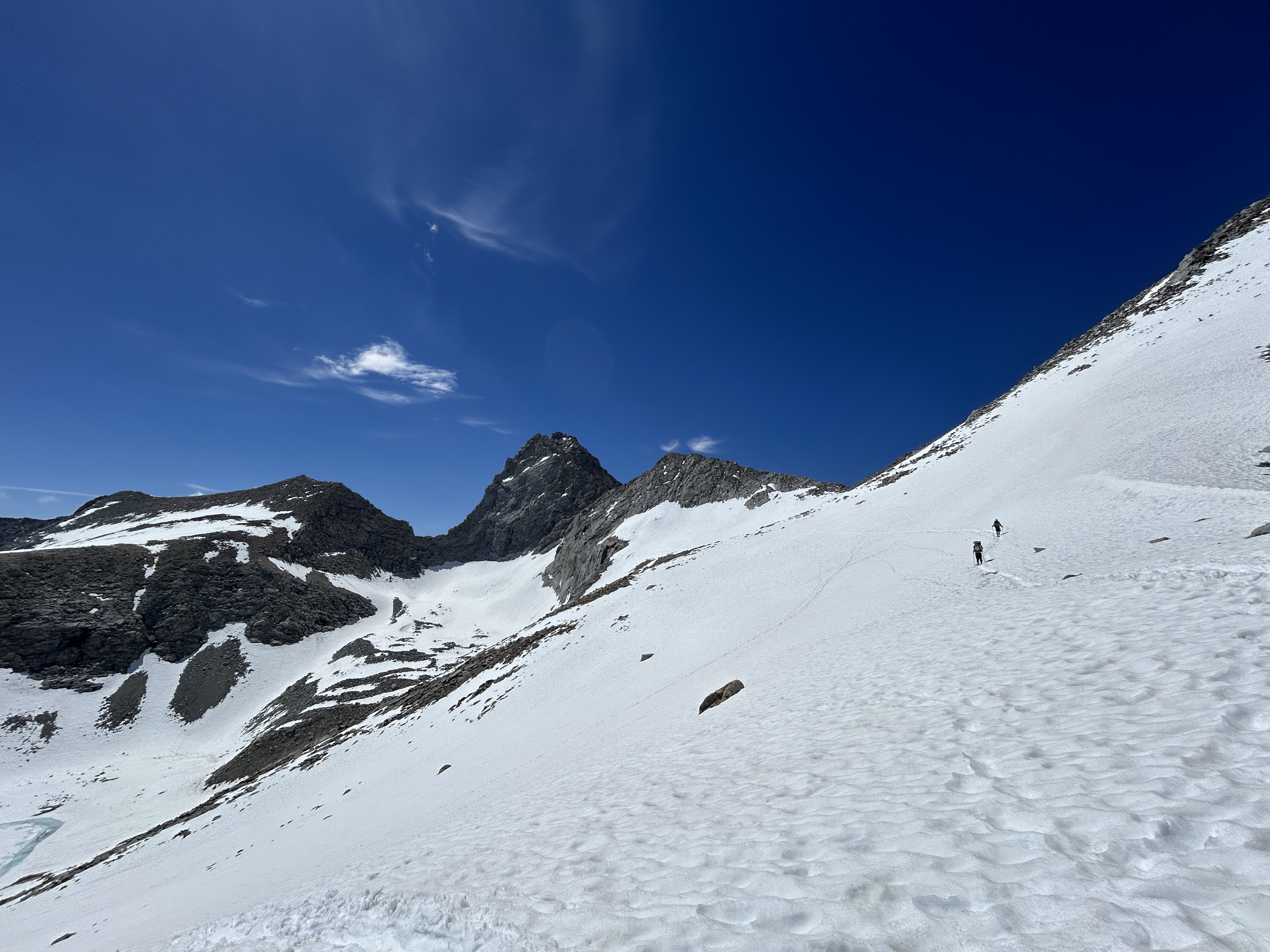
The rest of Day 49 involved hiking over Kearsarge Pass (which is not on the PCT but required to enter into the towns of Independence, Lone Pine, or Bishop). After about two hours and two hitches later, I made it into Bishop where I’ll spend the night and make my way back to trail tomorrow after completing the usual town chores and resupply.
 |
| Approach to Kearsarge Pass |
 |
| Summit of Kearsarge |
 |
| Proof that I made it |
Today was 33°C in Bishop (which felt especially warm when I was wearing a puffy jacket as all my other clothes were in the wash). Looking forward to hitting the mountains again where the altitude will provide a reprieve from the heat.
 |
| Town food in Bishop |
The next stop will most likely be in Mammoth Lakes in a week or so and will mark approximately the halfway point of California (it’s huge!).


Comments